Land use planning creates the conditions for diverse green infrastructure solutions by designing green networks that define street widths and other space reservations, among other things. To secure the broadest functional properties of green infrastructure and the broader production of ecosystem services in a city structure full of technical systems requires the competences and cooperation of various sectors and stakeholders.
Collaborative planning helps to increase support for green infrastructure planning by making the co-benefits visible [35]. This helps to increase the legitimacy of green infrastructure among various stakeholders [23], which contributes to the success of projects as measured by better managed and more resilient urban spaces. If implemented well, collaborative planning can be a process of co-creation and social innovation, and can result in improved societal well-being. For green infrastructure planning to work as a social innovation process, collaboration must be integrated into each phase.
Four phases of collaborative planning
Planning processes that make social innovation a goal require collaborative planning (co-planning) that involves several stakeholders, from researchers to practitioners and citizens, in a cooperative and iterative fashion. This supports the active participation of stakeholders throughout the various stages [36]. Co-planning is broken down into four phases below: co-assessment, planning and exploration; co-design and experimentation; co-implementation and maintenance; and co-monitoring and co-evaluation. The last two phases are often neglected or totally forgotten, but are crucial parts of the co-planning process. These phases involve not just technical but also social, financial, organisational and environmental aspects. Among the main challenges of collaborative processes are that the involvement of too many stakeholders can make them long and tedious, and make it difficult to track the critical changes that might lead to the failure of green infrastructure implementation. The key is to find the right balance depending on the issue and context, and to use the right tools to achieve this balance.
In the different phases of co-planning, stakeholders and their needs must be mapped, analysed and assessed. A wide range of stakeholders should be actively engaged early on in the green infrastructure planning process. Managing the trade-offs between the different benefits of green infrastructure and the priorities of interested parties requires working through conflicts and communicating in an effective and transparent fashion. This section has collected some in-person, online and digital methods and tools that can support meaningful engagement by the various stakeholder groups.
The co-assessment, planning and exploration phase is the first phase or the pre-planning process. It sets up the urban planning process. This phase assesses the challenges, the local context and the various potential solutions at the conceptual level. The suitability of solutions is assessed in relation to the context, analysing the situation from the problem, risk and opportunity perspectives. This phase is also an opportunity to gather information and understand the experiences, motivations and requirements of the different actors involved. Work with stakeholders results in decisions on which option(s) to explore further [37].
Example method
Collaboration for increased local value and longevity
Bee borders were constructed along the Pollinator Highway in Tallinn to make the area visually attractive for people while also offering a nectar-rich flowerbeds for pollinators. Involving officials from city districts and citizens who were willing to participate in the creation of bee borders was beneficial, as the work done together was more valuable and meaningful to each participant and increased the likelihood that the sites will be maintained and preserved in the future.
The co-assessment and planning phase introduces new ideas as entry points to urban planning in a city, and maps key stakeholders and relevant ways to engage with them to finalise option(s). The key sub-components of this phase are set out below.
Problem identification. The co-creation process for this phase is triggered by identification of current or potential future problem(s) by stakeholders such as researchers, local communities and government agencies. Issues such as ‘what is the question’ and ‘what are we trying to resolve’ are addressed in this substage.
Example method
Stakeholder Engagement for Tramway Alliance
In order to support coherent planning of the new Kalasatama Tramway and its surrounding area, Forum Virium Helsinki invited experts with different backgrounds working on the various Kalasatama-related projects to a multi-session design sprint. An initial introductory session with expert lectures on relevant subjects related to the sites was organised online. This was followed by a field visit to the area and work in smaller groups in three selected smaller areas. The groups documented observations and shared knowledge of the site, its uses, its problems and potential solutions, while also considering the surrounding context and stakeholders. The next day, the groups continued their work using an online whiteboard, and in a plenary session. This resulted in a better understanding of how the projects could support each other, new connections between different types of experts, and new or potential solutions to be integrated into the work.
A collaborative digital whiteboard resulting from multi-stakeholder work in a design sprint in Kalasatama Area of Helsinki. Credit: Forum Virium Helsinki.
Background research. Before starting the project, it is necessary to perform a baseline analysis of cooperation with stakeholders. This can be done using numerous methods from resident surveys to coordinated resident neighbourhood walks, interviews, participatory risk assessments or analyses of specific themes, such as biodiversity. This collects existing knowledge on the site, provides a common understanding of risk and development potential and brings in external expertise [39]. Further preliminary research onthe nature, scale and extent of the problem along with the social, environmental and economic costs related to it should also be undertaken at this time.
An example question from the resident survey which was conducted with Maptionnaire as a part of the B.Green project in Helsinki and Tallinn to map resident use in a particular area. Credit: B.Green project.
Performing a baseline analysis in cooperation with both internal and external stakeholders helps to gather existing knowledge of the site and lay common ground for cooperation. In developing a site around Skoone Bastion in the Old Town of Tallinn, the city saw an opportunity to support sustainable urban development through engagement with citizens and NGOs. Feedback was gathered using an online participatory GIS-based map survey, in which residents left comments related to specific locations in the area. This found that residents wanted more green areas and parks, better maintenance of existing playgrounds, and improved traffic conditions. To further increase their understanding of the situation, the city performed a participatory Strengths, Weaknesses, Opportunities, Threats (SWOT) analysis. This combined information was used as input into the initial draft structural plan for the pilot site [39].
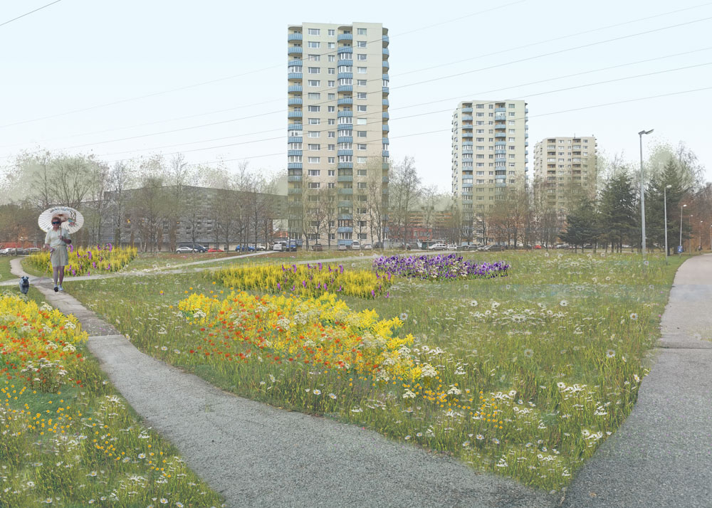
Biodiversity monitoring and pollinator assessment have been implemented in the Pollinator Highway in Tallinn to get an overview of the pollinators in the area, their species richness, and the condition of their community and habitat. The monitoring helps with making recommendations for maintaining and improving the condition of the pollinator communities and gives insight into creating the Pollinator Highway concept.
Defining the problem and objectives. The problem and objectives need to be detailed and prioritised according to their potential impacts – both positive and negative. What is feasible, and the accessible types of green infrastructure solution related to the problem and objectives are explored in this substage [37, 39].
Stakeholder mapping and analysis. The groups that could have an influence on or be affected by either the problem you are trying to resolve or any potential solutions need to be engaged with in the planning process. Stakeholder mapping is an iterative process that begins during the initial planning phases in order to identify these groups. There is a need to go beyond existing networks to engage with experts from other disciplines. Stakeholder groups should represent all the main sections of society. Examples include authorities from government agencies, political representatives, civil society, the commercial sector, academia, the media, and international and expert organisations (see Figure 21). Vulnerability assessments can be used to identify those vulnerable to climate risks. For a holistic and resilient intervention, the stakeholders affected by the measures should also be included, even if they reside outside the municipal borders, for example downstream of water-related interventions, as impacts might take place downstream [38].
Different stakeholders have different competencies, values and expectations. The expectations of different local government departments and other actors can be managed as part of the stakeholder analysis. Conducting stakeholder analysis helps to identify the characteristics of stakeholder groups and choose the best way to involve them in the process, introduce them to the activities and motivate them to participate. It is also a useful tool for understanding how to handle power imbalances. Carrying out a proper stakeholder analysis enhances equity, since it helps to identify those who might be greatly affected by the development and thus need special attention, and those who have a clear interest in the development even without special efforts by the planning organisation [39]. Stakeholder analysis is an iterative process involving stakeholder identification and mapping. It should take place before the stakeholder involvement plan but alongside the baseline analysis [38]. For information on various steps and tools to stakeholder analysis.
In B.Green, the Tallinn City Strategic Management Office began stakeholder mapping related to the Pollinator Highway which passes through nine very different types of neighborhoods by gathering public data available from a variety of sources, such as Google Maps, the Republic of Estonia Land Board’s geoportal, the accessibility information system LIPS, the Population Register, the Tallinn City Planning Department and Statistics Estonia datasets. This generated a map of preliminary stakeholder groups in the project area’s contact zone (within a 600m buffer from the Pollinator Highway) that outlines the location of businesses, residents and public service establishments (government offices, healthcare points, public institutions, local community groups, leisure and recreational functions, and educational services) in relation to each other and their concentration in the different parts of the project area (see Figure 22). It also disaggregated the data into types of business, their clientele, resident ages, primary languages, education and population density, as well as whether residents lived in houses or apartment buildings. These maps were then used to further map individual stakeholders in the different parts of the Pollinator Highway.
Preliminary planning.Having developed a comprehensive understanding of the problem and set out some potential solutions, there is a need to explain and communicate these to different stakeholders. This brief communication should include the purpose, the audience that is being served, success metrics, and an initial roadmap that includes the constraints, a timeline and a budget [37].
Example method
Utilising informal processes for gaining buy-in
Cooperation with stakeholders during the green infrastructure pre-planning phase can be supported by an informal participatory planning processes. A joint vision was formulated with diverse stakeholders in Turku, Finland, in 2016 while developing the Turku Science Park area 2050. After identifying key stakeholders and conducting workshops, a four-day Turku Future Forum event was organised that managed to successfully engage with a larger group of actors. The dual purpose of understanding the needs of stakeholders and creating a sense of community buy-in was spurred through a range of activities, group discussions and participatory methods. Following the success of the event, ideas were gathered and fed into the common vision. The Turku Future Forum concept has since been used in other development projects [39].
Traditionally, stakeholder engagement begins too late. This phase is the ideal time to begin stakeholder engagement, starting with stakeholder mapping and coordination, but is considered challenging in terms of participation. One participant noted that ‘it is considered too early to share ideas and concepts and then all of a sudden it is too late to give feedback’ (Participant, B.Green workshop 13.01.2021).
Kerrokantasi is an online engagement tool used by the City of Helsinki for urban planning. Credit: City of Helsinki
2) Co-design and co-experiment
The second phase of co-creation planning goes deeper into the roots of the problem to develop ideas and potential solutions in a way that leaves room for multiple iterations [8]. Co-design and experimentation in green infrastructure is data-driven and based on the principles of stakeholder participation. A data-driven approach that includes climate resilience data, green network interaction data, health impact assessments, citizens’ preferences and use-of-space analysis helps to determine which design options meet the needs of which stakeholders and how. Participatory methods can be used to support the co-design, as well as experimentation. At this stage, continual feedback from the co-experiment stage can be used to create an optimal solution [37].
Example method
Collaboration for shared decision making
The City of Tallinn has conducted an open competition to place art installations in different parts of the Pollinator Highway. First, residents were involved in mapping locations on the Pollinator Highway that needed something to enliven interactions and provide enjoyment opportunities. Second, an open competition was held to get ideas for temporary, innovative, ecologically sustainable pieces of art. A diverse expert jury selected two pieces and an online public vote was held to select the third installation.
Campaign image used by Tallinn for announcing the art installation competition “Place Buzz” which included online public voting as a decision making method. Credit: Tallinn Strategic Management Department, Spatial Design Competence Centre.
Students of Pioneer Erasmus Mundus Master Program were looking for new ideas for the Tallinn’s latest green infrastructure initiative – the Pollinator Highway. Credit: Taltech – Tallinn University of Technology
The co-design and co-experiment stage allows stakeholders to identify solutions and new opportunities together, in order to test these out later on in the process. Solutions need to be designed with benefits and people in mind. The major sub-components of this phase are set out below.
Identification of potential design options. First, potential design options are identified based on the potential for the land use to serve multiple functions and provide multiple benefits and co-benefits. To understand the benefits, the value of the green infrastructure must be captured and quantified. Conceptual frameworks that capture business opportunities such as ecosystem services can be used for this purpose.
Designing with people. Designing with people involves engaging with local communities in addition to local government to embed solutions in local city planning strategies. Participatory planning processes that involve bottom-up approaches can be enhanced by a clear and transparent communication process of the actions planned. This helps to foster community initiative and incorporate green infrastructure into government policies, which later plays an important role in the maintenance and operation of the project [38].
Avalinn is an online engagement tool used by the City of Tallinn for urban planning. Credit: City of Tallinn.
Identification of benefits and risks for different stakeholders. Identification of the benefits and risks for the stakeholders helps to design a better solution. Responsibility and a sense of ownership should be equally distributed among several stakeholders, including citizens, based on the risks and benefits of the projects. Financing aspects should also be kept in mind at this stage.
Example method
Risk Analysis or Assessment of Potential Solutions
Recognition of different types of risk and discussion of these with stakeholders and politicians create a common understanding and help to address conflicts in the early stages of the development process. If identified at the beginning of the process, potential risks can be mitigated and the necessary measures taken. Among the different types of risk are: financial risks, such as lack of funding, higher than expected infrastructure costs and low levels of investment; environmental risks, such as high levels of contaminants; and participation/cooperation risks, such as lack of commitment, low participation levels, lack of interest, resistance to change, conflicting visions and hostility towards participatory planning approaches. There are also risks related to management and coordination, such as lack of communication, unclear roles and responsibilities, delays, the lack of an integrated approach, weak cooperation between sectors and conflicting targets, as well as institutional risks such as a lack of long-term political commitment and a lack of collaboration between departments [39].
Finalising and testing a prototype. After the above steps, prototypes of the solutions can be finalised and testing of the design strategies carried out [37, 38].
Pollinator Highway video with sketches which show how the area might look. Credit: Tallinn Strategic Management Department, Spatial Design Competence Centre
Deciding on the desirable solution. Finally, a decision can be made on whether a desirable strategy is the best one or needs to be improved or rejected. These steps are carried out several times, involving constant feedback through stakeholder participation and consultation to reach the most desirable solution(s) [37].
Example solution
The Aurora-block in southern Kalasatama
The Aurora-block in Sompasaari in southern Kalasatama has an above average amount of GI-solutions, including a stormwater management system integrated into an artistic landscape architecture plan. Several roof gardens and three sets of IoT-sensor arrays, that measure weather, soil moisture and activity within an area of proximity. Additionaly, a submerged sensor measures water temperature on a pier next to the Aurora-block. These sensors are being tested to gather data on environmental parameters in the area.
An aerial view of an inner courtyard with green infrastructure and green roofs in the Aurora Block being constructed in Kalasatama. Credit: B.Green project (Lauri Lemmenlehti)
The catalogue is a collection of almost 900 plant species suitable for both urban green areas and gardens in Estonia and other countries with similar climate. With the help of the catalogue, gardeners and landscape architects can make more informed choices and select the most functional plant species, which, in addition to being eye-pleasing, have a significant value for pollinating insects, birds and other animal species.
The users can search for plants by various classifications, such as: plant species or type; plant height range; flowering time or the colour of flowers; requirements for soil, moisture or light; pollinating insects on the plant (bumblebees, butterflies, etc.) or the value for pollinators (assessment on a five-point scale); intended location of use (street, park or garden); origin of the plant (native in Estonian nature, or an introduced plant species); other characteristics (e.g. edible/poisonous/medicinal plant, suitable for groundcover/hedge). The search results can be saved as a PDF file. The catalogue is available at:
In B.Green, an online participatory GIS survey was conducted in Tallinn and Helsinki. The aim of the survey was to explore the opinions of Helsinki and Tallinn residents related to the planning of urban nature elements. The questions explored the values of urban nature and participation in urban planning, respondent use in and through the areas, as well as in Tallinn, the respondent’s preferences for green space related amenities within the area. The survey consisted of 8–13 question blocks, depending on the respondent’s answers.
Players engaged in the Globescape, a serious game, in Helsinki. Credit: Johann Schuur
3) Co-implementation and maintenance
After identifying the best solution, the next phase is co-implementation and maintenance, which includes not just technical but also social, financial, organisational and environmental aspects [37]. This requires an understanding of regulatory processes and the approval of different actor groups and organisations [38]. The co-implementation stage entails management of the planned solution and the overall budgeting associated with it. At this stage, stakeholder expertise is needed on procurement processes, permits and maintenance, as well as coordinating with and obtaining feedback from the stakeholders involved in both implementation and maintenance [37]. Since this phase involves different stakeholders, collaborations can easily be overlooked during planning.
Example tool
Urban meadow instructions for stakeholders
The urban meadow created as a part of the Pollinator Highway in Tallinn provides several types of insects in the area with various nectar-rich flowering plants while also offering a pleasant environment for the area’s visitors. In order to increase the level of native species in the city, the city of Tallinn drafted instructions to guide people and other stakeholders in creating further urban meadows and increasing local native biodiversity. These are available from the Tallinn Botanical Gardens
A vision of the meadow on the Ehitajate tee 105c property in Tallinn the third year after sowing (summer 2023). Credit: Tallinn Strategic Management Department, Spatial Design Competence Centre.
Several actors are involved in the continuous iterative process of implementation and maintenance. This should be planned at the pre-planning stage even though it takes place much later. The three main types of actors involved are core governance, technical staff and quality control. Each has different roles and responsibilities. The co-implementation stage involves activities that range from detailed planning and design of solutions, to construction processes, commissioning and risk management of those solutions, alongside delivery of the project within budget and on time according to certain quality specifications. This is followed by a gathering of the stakeholders, including members of the public, to justify and explain the solution and share information about how it can be maintained. This enhances trust and lays the groundwork for future implementation. To ensure its future maintenance, the owner(s) of the implemented project need to be established. These should include the end-users of the project as they will be the ones who will be directly affected. The challenge will be to convince them to participate in the co-ownership process and consequently its maintenance [37].
Maintenance ensures value creation
In property construction, the maintenance of green solutions should be planned as early as possible. Solutions such as integrated watering systems for green roofs should be implemented as the building is constructed, and watering plans should be prepared during the design phase. The design of maintenance solutions is similar in terms of importance and difficulty to the design of heating, plumbing and the electricity supply. The Greenest of the Green block in Jätkäsaari is an example of an extensively designed green infrastructure solution where the green walls are maintained by watering technologies integrated into the building. Bringing in a heating, plumbing and electricity engineer may prove surprisingly inexpensive and save time if solutions can be found early on. The future maintenance workers should also be involved in the design of green solutions and use made of their expertise when making design choices.
The transfer of responsibility from planning to implementation and then to maintenance has been identified as a recurring challenge. Cooperation still requires significant changes in the approaches of many professionals. In business models, the lifecycle perspective is implemented in such a way that the solution implementer will also be responsible for maintenance. In new kinds of green infrastructure solutions, this gives developers and clients a key role in promoting change. In Denmark, for example, companies building and maintaining green infrastructure solutions are already granted quality certifications that verify their expertise even in more complex solutions. In Finland, the companies implementing and maintaining these solutions may also specialise further in the future.
New dynamic green infrastructure solutions may require professional maintenance services. Credit: Forum Virium Helsinki.
4) Co-monitoring and evaluation
Co-monitoring and co-evaluation play a significant role in assessing the effectiveness of green infrastructure solutions in terms of achieving the desired co-benefits. Factors in what worked and what didn’t are scrutinised. The monitoring phase actively seeks explanations for the issues and tries to find solutions to the shortcomings identified. Green infrastructure solutions often resolve wicked problems that involve multiple stakeholders, making it necessary to evaluate the process to identify which solution(s) are best aligned with which objectives [37]. In the co-design phase, a comprehensive monitoring plan should be created to identify aims and objectives, and the roles and responsibilities of the stakeholders involved [38].This phase is crucial to understanding how successful the green infrastructure and co-creation processes were through feedback from practitioners and end-users [37, 38].
Campaign image advertising a citizen science species monitoring marathon event. Credit: University of Tartu Natural History Museum and Botanical Garden
Monitoring of effectiveness against co-developed aims and targets should already be envisioned [38] at the co-planning stage. Monitoring can be carried out collaboratively using co-created indicators as metrics are most effective when link to the objectives and values of the project and its stakeholders [40]. As urban green infrastructure relates to both the natural and built environment, as well as to people, indicators should reflect the various components, along with issues, such as cost, etc [2]. Indicators should also reflect both short- and long-term successes of the project. For these monitoring activities to be carried out, data or information will be needed on climatic conditions, the situation before and after implementation of the green infrastructure, the potential impact of the green infrastructure solution and the range of social, economic and environmental co-benefits, among other things.Following integration of the results into the decision-making processes of the different stakeholders, these measuring systems become an influential policy tool [38]. Participatory monitoring such as citizen science should also be considered and included in the co-design stage, as it helps to gather the new types of information needed on climate adaptation and resilience, and on other co-benefits.
Example method
Biodiversity and pollinator monitoring
Biodiversity monitoring and pollinator assessments have been implemented in the Pollinator Highway in Tallinn to obtain an overview of the pollinators in the area, their species richness and the condition of their community and habitat. This monitoring helps generate recommendations for maintaining and improving the condition of the pollinator communities and provides insights into the creation of the Pollinator Highway concept.
Co production indicators or stakeholder monitoring tools
There is a need to develop and test robust indicators for monitoring and evaluating participatory processes in order to demonstrate their value. This increases the credibility of the results and shows the value of stakeholder involvement during planning processes. It also reflects best practice for stakeholder involvement. Indicators for monitoring green infrastructure and participation should be developed during the co-assessment phase and reflect a number of dimensions relevant to assessing the success of co-creation in a process or project. Examples include: relevance, or whether the project contributes to generating solutions that stakeholders consider relevant; inclusion, or whether co-creation led to an inclusive process characterised by openness and transparency, where equal recognition is granted to all contributions; and learning, or whether the co-creation process produced social learning and, if so, at what scale [38]. In B.Green, SEI Tallinn developed a participatory method evaluation method based on an earlier study (see link below). The evaluation can be used by internal and external stakeholders to both plan processes and evaluate their implementation. The method covers issues such as the degree and timing of involvement, representativeness, transparency, accessibility of resources as well as content, facilitation, definition of goals, as well as results.
Finance should be considered in all four phases of co-planning. Budget constraints, as highlighted above, are a frequent barrier to the implementation of green infrastructure. Long-term financial plans have to be put in place for the entire implementation period and for later maintenance. Furthermore, owing to the novelty of green infrastructure, funding must be allocated to the monitoring and evaluation stages of the project [29, 30]. In anticipation of financial risks and cuts, technical specifications (e.g. the number of the trees, green roofs and surface coverings) can be designed in a flexible way that can be adapted [26]. Moreover, citizens and local communities can be involved in the maintenance and monitoring stages, although citizen-led initiatives might need technical guidance and support. Maintenance costs can also be passed on to a third party where the owner values the intervention and is willing to accept long-term stewardship [26]. In different phases of co-planning, stakeholders and their needs must be mapped, analysed and assessed. A wide range of stakeholders should be actively engaged in the green infrastructure planning process early on. The diversity of goals needs to be mapped to increase stakeholder interest and in turn increase the size of the pie. This all then needs to be communicated in an effective and transparent fashion.
Space reservations and street structures facilitate green infrastructure
Green infrastructure is connected to other types of infrastructure, such as traffic infrastructure, underground infrastructure and heating, plumbing and electrical infrastructure. Green infrastructure solutions might redirect various types of traffic, landscape car parks, diversify public transport stops or absorb and redirect rainwater on the streets. The street structure also continues underground. In particular, the roots of urban trees require sufficient space, and pipelines and telecommunications cables also compete for underground space. These are often divided into sectors by service providers. Copenhagen has had positive experiences of implementing multi-functional solutions in the street space, through which costs are divided between multiple operators. In this way, the solution created should be both less expensive and higher quality.
Mapping benefits and co-benefits has been repeatedly identified as a challenge when funding and delivering green infrastructure services. The Business Model Canvas is a tool that allows teams to think differently about products and services. The method guides the mapping of customers, and the benefits available to each, and in turn enables users to define the next steps, the challenges and how to monetise the gains. Other spatial mapping and assessment tools can be used to locate, identify and quantify the different functions and services of green infrastructure in a city, which can be extremely useful for mapping the vulnerable areas and delivering maximum social impact.